Home page » Ecology services » GIS
GIS (Geographical Information Systems)
Ecology mapping services
Geographical Information Systems are a powerful tool in many areas of ecological work including research, impact assessment, planning and development. The Wildlife Partnership is able to combine proven ecological expertise with GIS mapping software to deliver accurate and interactive mapping and analysis of survey data. The application of ArcGIS (versions 3.2/9.3 including Spatial Analyst and 3D Analyst) to survey data is a key aspect of our reporting and provides both quantitative and qualitative improvements to survey data including:

- Phase 1 Habitat Survey
- National Vegetation Classification (NVC)
- Bird Flight line data for wind farm developments
- Species Distribution
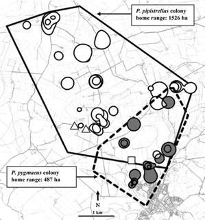
In addition GIS techniques can be employed for more complex spatial analyses of animal movement patterns including:

- Home Range Analyses:
- Minimum Convex Polygons
- Kernel Analysis
- Hierarchical Cluster Analysis
- Collision risk modeling;
- Ecological Niche Factor Analysis
